
 Analytics and research

 19 August, 2026
 Scooter Sharing Software Geofencing Solutions: The Operator’s Guide
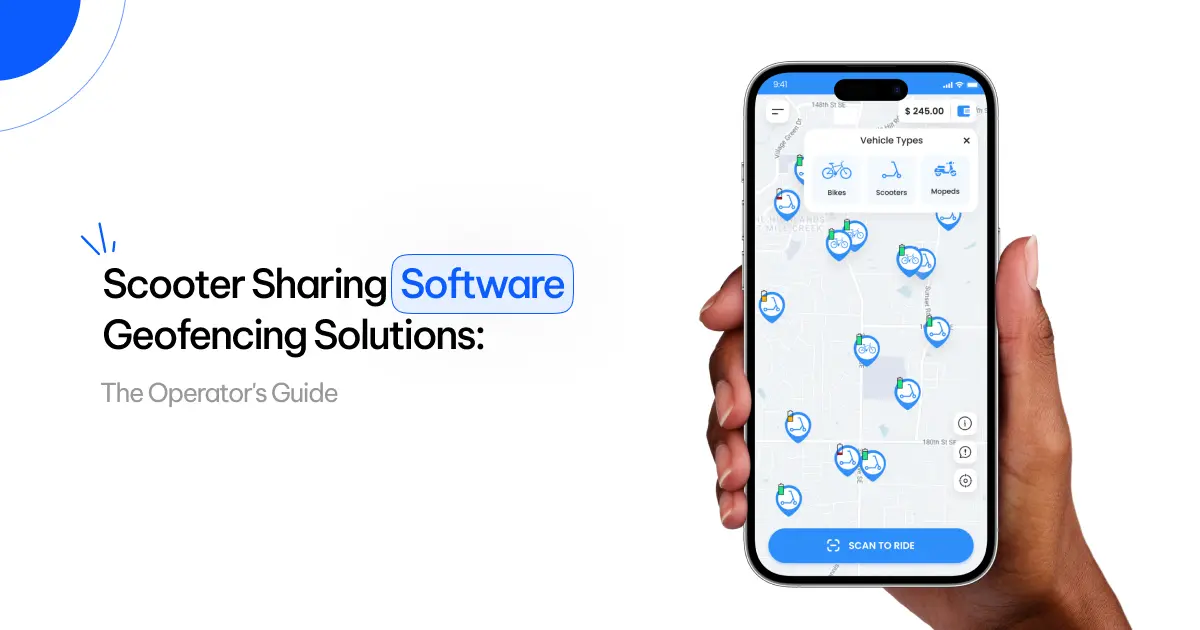
Scooter sharing software geofencing solutions are the GPS rules inside your fleet platform that slow, stop, or refuse to end a ride based on exactly where a scooter is. They turn a city’s invisible map of no-ride zones, slow zones, and parking corrals into real-time actions on the vehicle. Get them right and riders never notice. Get them wrong and you don’t just annoy customers. You lose the permit.
In deployments we’ve supported, operators using EazyRide’s geofencing zones report up to 40% fewer parking violations than manual enforcement. That gap is the whole game. This guide walks through how geofencing actually works, the three zones every city audits, the GPS accuracy trap most vendors won’t mention, a launch-week playbook for drawing your first zones, and how to score the software underneath it all. If you want the deeper build view, the scooter sharing system design guide pairs well with this one.
Key Takeaways
- Geofencing is now a permit rule, not a feature.
- Three zones do the work: no-ride, slow, no-park.
- GPS drifts 3-10 meters and breaks weak fences.
- EazyRide cuts parking violations up to 40%.
- Your software, not hardware, is the real moat.
What Is Geofencing in Scooter Sharing Software?
A geofence is a virtual boundary drawn around a real place: a park, a campus, a downtown core, one blocked storefront. Geofencing in scooter sharing software is the logic that detects when a scooter crosses one of those lines and fires a programmed response with no human in the loop.
Here’s the mechanism. The scooter’s onboard GPS reports its location continuously. The fleet platform compares that position against a library of zone polygons the operator and the city have drawn. When a scooter enters, exits, or tries to park inside a zone, the system issues a command: cut top speed in half, block the ride from ending, push a warning to the rider’s app, or trigger a parking-photo step.
The shift over the last few years is that this enforcement moved from advisory to hard. Advisory means a polite notification. Hard means the scooter physically can’t exceed the limit or end the trip illegally. Cities now expect hard enforcement, and your software has to deliver it every time, not most of the time.
Why Geofencing Decides Whether You Keep Your Permit
The shared micro-mobility market is big and still growing fast. Grand View Research puts it at roughly $46.3 billion in 2025, heading toward $126.5 billion by 2033 at a 13.3% CAGR (Grand View Research). That growth pulled regulators in, because the same scooters that move people also clutter sidewalks and send riders to the hospital.
The safety numbers are why cities keep tightening the rules. U.S. emergency-department visits tied to micromobility products climbed from about 37,300 in 2017 to roughly 149,100 in 2024, an average annual jump near 23% (U.S. CPSC). When injuries and sidewalk complaints rise, the pressure lands on the permit, and the permit lands on you.
This is where geofencing earns its keep. In Munich, e-scooter parking compliance rose from 71% in 2022 to about 90% in 2023 after geofencing rules took effect, and more than 90% of pedestrians welcomed the regulation (JPI Urban Europe). In Chicago, enforced parking interventions drove 97.3% audit compliance and a 78% drop in complaints (Active Travel Studies). For an operator, that’s fewer fines, fewer impounds, less re-parking labor, and a city that renews your contract instead of handing it to a rival. The scooter sharing market trends and growth forecast covers where that demand is heading.
The Three Geofence Zones Every Operator Needs
Most city programs and well-built platforms run on three zone types. Master all three and you’ve covered the baseline every permit expects.
1. No-Ride Zones
These are areas where scooters are banned outright: pedestrian-only plazas, transit platforms, school grounds, hospital campuses. When a scooter crosses in, the software eases the motor to a stop, never an abrupt cut that throws the rider, and prompts the user to leave before riding resumes. Good systems decelerate smoothly and warn the rider before the boundary, not at it.
2. Slow Zones
Slow zones cap top speed in busy or sensitive areas: a beachfront promenade, a crowded market street, a downtown core at rush hour. The scooter keeps moving but at a software-enforced limit, commonly 5-8 mph instead of 15. Slow zones are the workhorse of safety compliance because they cut collision severity without stranding anyone. The best systems schedule them by time of day, so a plaza runs full-speed at 6 a.m. and crawl-speed at lunch.
3. No-Park and Mandatory-Park Zones
Parking is where most complaints start, so this zone type protects your reputation most directly. No-park zones stop a rider from ending a trip in a forbidden spot: in a doorway, on a wheelchair ramp, blocking a bus stop. Mandatory-park zones, or parking corrals, force the rider to end the trip inside a marked area, often with a confirmation photo. Try to end a ride outside the rules and the meter keeps running until they comply. That single mechanism is what drove the compliance jumps in Munich and Chicago.
The Accuracy Trap: Why GPS Precision Makes or Breaks Geofencing
Here’s the problem few vendors advertise: a geofence is only as good as the location data feeding it. Consumer-grade phone and scooter GPS usually lands within 3-10 meters, while precision techniques like RTK can reach 2-3 centimeters (Sensors / NCBI).
Five meters sounds trivial until you map it onto a real street. Five meters is the difference between the sidewalk and the bike lane. A scooter that thinks it’s off by that much can refuse to end a legitimate ride, which infuriates the customer, or allow an illegal park, which infuriates the city. In dense downtowns, tall buildings create urban-canyon GPS errors exactly where compliance matters most.
Strong scooter sharing software geofencing solutions attack the gap on several fronts:
- Tight, intelligent buffers around zone polygons so minor drift doesn’t trigger false enforcement.
- Sensor fusion that blends GPS with the scooter’s accelerometer, compass, and even computer vision to tell sidewalk from street. Lime reports up to 95% accuracy in detecting sidewalk riding, with geofence commands running up to 90% faster than older systems (Lime).
- Fast command latency so the scooter reacts the instant it crosses a line, not three seconds later.
When you evaluate platforms, don’t accept “we support geofencing” at face value. Ask about positioning accuracy, buffer logic, enforcement latency, and how the system behaves during GPS dropout.
Your Launch-Week Playbook: The First Five Zones to Draw
Most guides tell you geofencing matters and stop there. Here’s what almost none of them give you: the exact zones to draw before day one in a new city. We’ve found that operators who map these five before launch spend their first month growing rides instead of firefighting complaints.
- Your service-area boundary. One outer polygon that defines where rides can start and end at all. Everything else lives inside it.
- The top three complaint magnets. Pull the city’s past 311 or parking-complaint data and fence the worst offenders as no-park zones first. It’s the fastest way to protect your renewal.
- Transit and pedestrian cores as slow zones. Around stations and busy plazas, cap speed before you ever need a no-ride zone. It’s less disruptive and still cuts risk.
- Two to four mandatory-park corrals per square mile in demand hot spots. These concentrate scooters where riders actually want them and make rebalancing cheaper.
- A firmware-independent update path. Confirm zone changes push over the air. EazyRide pushes zone-rule changes to every vehicle in real time with no firmware update, so a 48-hour city mandate doesn’t become a two-week engineering project.
Your field team executes the physical side of this: relocating misparked scooters, checking corrals, swapping batteries. A tool built for that work, like a dedicated field operator app, keeps those tasks off your ops desk and out of your inbox.
How to Evaluate Scooter Sharing Software Geofencing Solutions
When you compare platforms, score each against the criteria below. These separate software that scales from software that loses your permit.
- Zone flexibility. Unlimited custom polygons, per-zone speed limits, time-and-day scheduling, and limited city access to define zones.
- Hard vs. soft enforcement. Does it physically throttle and block, or only notify? Cities increasingly require hard enforcement.
- Positioning quality. Real-world accuracy, plus the sensor fusion or correction used to beat raw GPS drift.
- Enforcement speed. How fast a command reaches the scooter after a crossing. Sub-second matters in slow zones.
- Operator dashboard. Live fleet positions, violation heatmaps, and parking-compliance rates in one view, editable without a developer.
- Rider experience. Safe deceleration, warnings before the boundary, and a quick parking-photo flow.
- Reporting for cities. One-click export of the compliance reports regulators ask for at renewal. This alone can win contracts.
- Offline resilience. On signal loss, does it fail safe and default to restrictive, or fail open?
Geofencing as a Revenue Lever, Not Just Compliance
It’s easy to treat geofencing as a defensive cost. The operators who win treat it as offense too.
Mandatory-park corrals concentrate scooters where demand is highest, which lifts utilization. And demand is heavily concentrated: 40% of all dockless e-scooter trips happen in just 10 U.S. cities, out of 157 million shared micromobility trips across the U.S. and Canada in 2023 (NACTO via UC Berkeley CATSIP). A parking strategy that keeps scooters available and visible in those hot zones directly grows rides.
Geofencing also unlocks dynamic incentives. Give riders credit for ending trips in an under-supplied corral and you rebalance the fleet for free. Open premium zones during events and you lift revenue per scooter. Used this way, the same boundary that keeps the city happy also cuts your manual rebalancing cost. Zone rules like these are drawn and enforced from a single fleet management dashboard. If you’re weighing a build-versus-buy path to get there, EazyRide’s white-label vehicle sharing software lays out the fastest route to launch.
Frequently Asked Questions
What is geofencing in scooter sharing software?
Geofencing draws virtual zones that automatically control a scooter’s speed, ride access, or parking the moment it crosses a boundary, with no staff intervention needed.
Do cities require geofencing for scooter permits?
Increasingly yes. Many US and European programs mandate enforced no-ride zones, slow zones, and parking corrals, and they audit that compliance at permit renewal time.
How accurate is scooter sharing geofencing?
Raw consumer GPS is accurate to 3-10 meters. Advanced platforms add buffers and sensor fusion, GPS plus accelerometer and vision, to reach far higher real-world reliability.
Can geofencing grow revenue, not just cut fines?
Both. Mandatory-park corrals concentrate scooters in high-demand spots to lift utilization, and zone-based incentives let you rebalance fleets and run premium pricing during peak events.
How long does geofencing setup take to launch?
For a white-label build, most operators go live in about two weeks. Zone rules can then change in real time without any vehicle firmware update.
The Bottom Line: Launch and Scale With Geofencing Built In
Geofencing is the line between a fleet that earns its city’s trust and one that gets pushed out. The operators who thrive run software that enforces the rules automatically, accurately, and fast, then turns those same boundaries into a utilization and revenue edge. Your hardware isn’t the moat. The rules engine behind it is.
Scoping a 2026 launch, or fighting parking complaints on your current platform? Book a demo of EazyRide’s scooter sharing software with geofencing and see how fast you can get a compliant fleet on the road.


